The people and places that made Bungonia what it is today
The Known Old Bungonia Mines
Bungonia mines have provided a strong foundation for the growth and development of the township since European settlement. As we have covered elsewhere the quality of the diggings provided a substantial and valuable resource for Aborigines well before the resources were "discovered" by later explorers.
Looking for Bungonia Specific History Archives? They are held in Goulburn Workspace by courtesy of Goulburn Mulwaree Council. Please use our contact form to arrange supervised access. You cannot do it through the council or the library.
Green Porphyry
There is a Porphyry mine on Mountain Ash road [old Bungonia Road] on a property called “Wylora”. It is located between 5.5 and 6 K from Goulburn town on the left laneway.
The laneway turns into 200metres; on right there is a bend - look on the right hand side. This is the closest location we can pinpoint, although the site has been back-filled. Ref. John Jervis A.C.T. historian
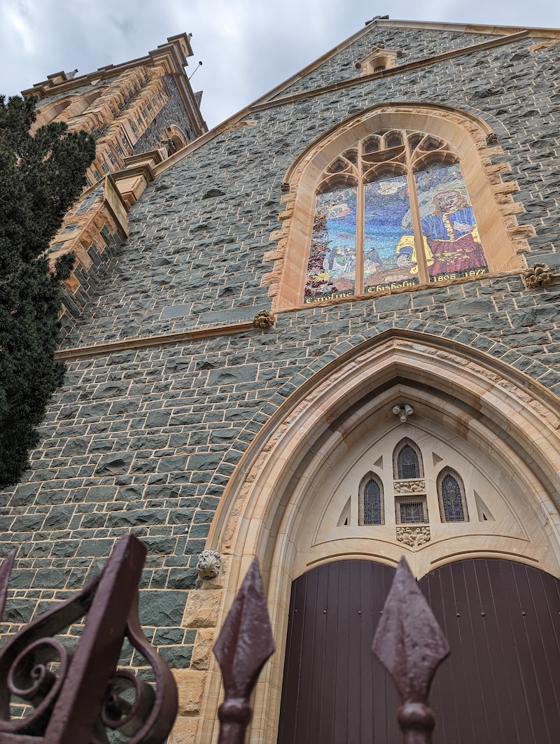
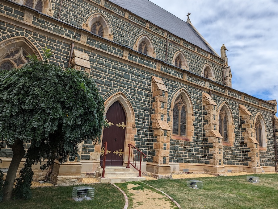
Green Porphyry is a Diorite igneous rock and was mined on the Bungonia Road [exact site not known]. It has been used extensively on the Sts. Peter and Paul’s Pro Cathedral site in Goulburn city.
Decorative window edgings and tracery, buttress elements and other ornaments are of Bundanoon Sandstone.
This was located on the Eastern side of the Shoalhaven Gorge, further north, and is easily visible as the edge of the Sydney sandstone basin at Tianjarra Falls (on the new Route 92) from Bungonia to the Coast.
This recently restored church boasts that it is the ONLY green stone church in the world.
Bundanoon Sandstone
Bundanoon sandstone is the main building material [finely dressed and cut into ashlar blocks] of the Anglican Christ Church (1896) in the Village of Bungonia. Christ Church is listed on the NSW State Heritage Register.
White pipe clay
There are deposits of white pipe clay at a Revesdale site. A wide seam of commercial china clay deposits have been systematically mined and were sent to Sydney for use in making clay pipes and domestic vessels.
The Tolwong Mines
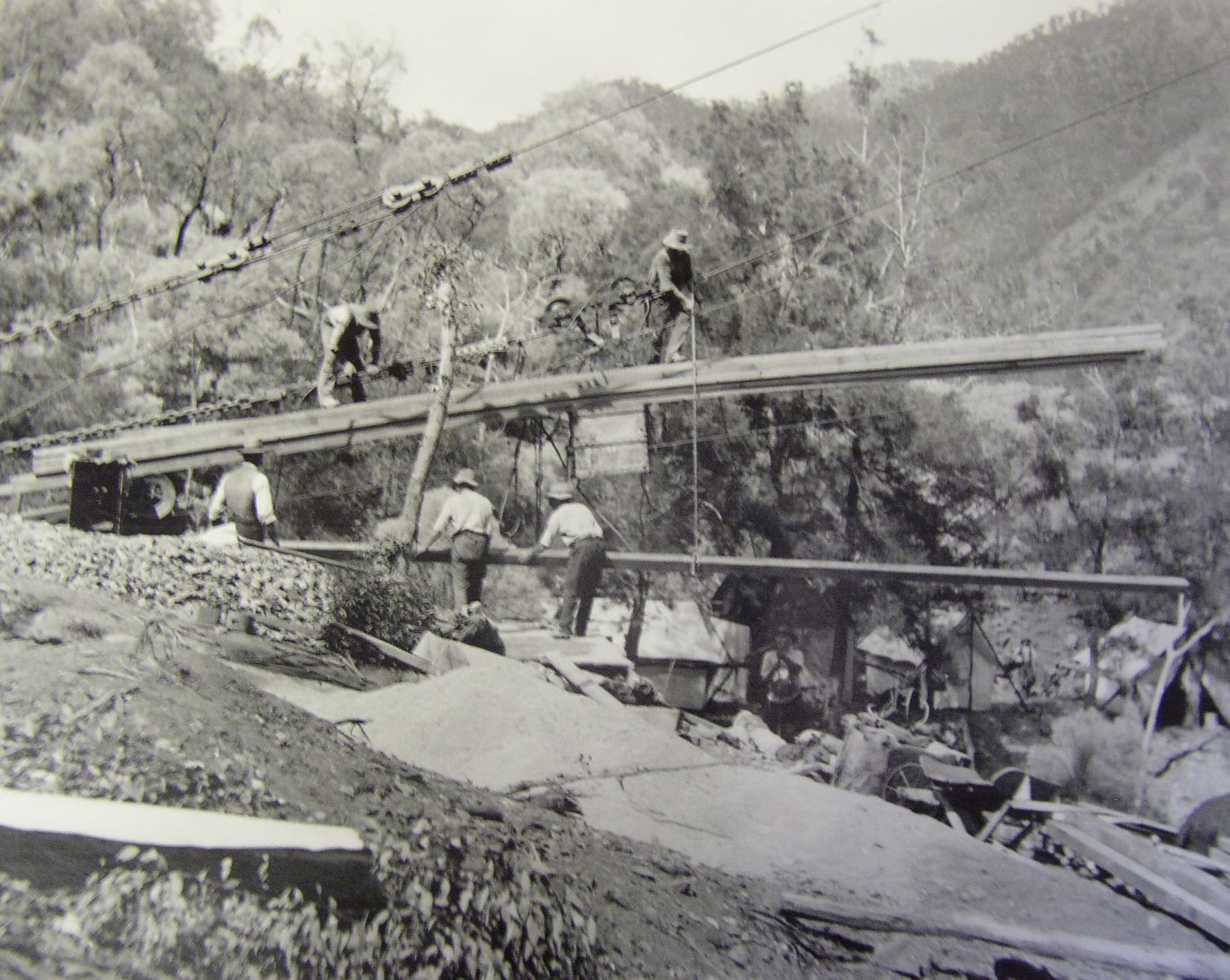
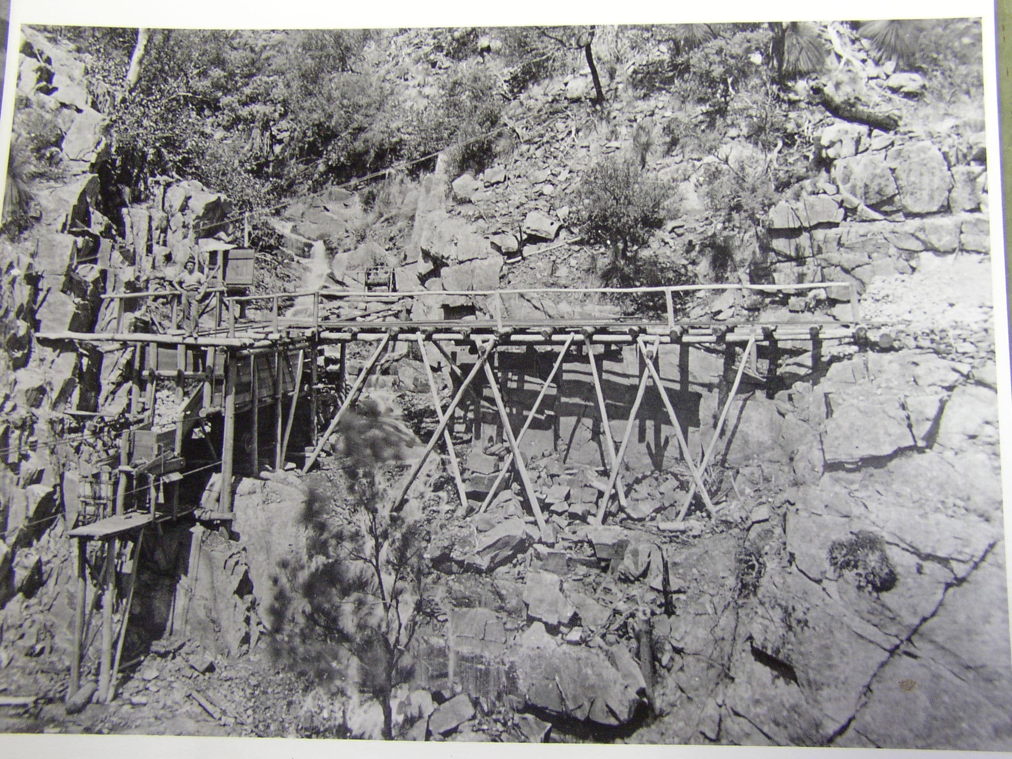
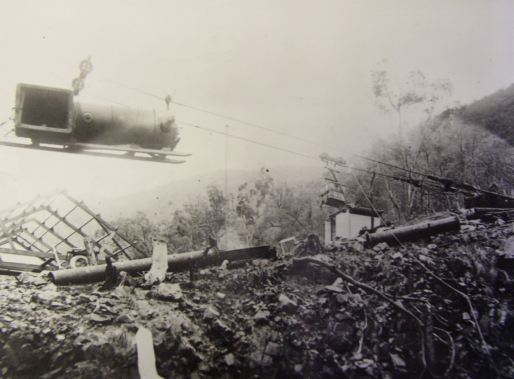
The Tolwong mines were a series of huge brick chimneys built up from the floor of the Shoalhaven river. A source of copper, tin and arsenic deposits, they were eventually closed after the outbreak of the war with Germany. At that time, the arsenic was separated from the rocks by fractional distillation in the tall chimneys and sent to Germany for the purification of gold, which was seen to be aiding the German war effort.
Within the Bungonia National Park lands, the Trestle Track name marks the beginning of the huge trestle structure that was powered by steam engines and windlasses to move building materials, machinery and lifestyle needs across the river valley to the Eastern side. The products were to be collected and hauled by bullock team drays -anything up to 24 bullocks - into the Goulburn rail head.
Mabel Morris spoke of the huge labour involved in demolishing the machinery and steam engines, and the 6 weeks it took to drag items to Goulburn over the regularly flooded creeks and the winding unmade roads.
You can download an excellent, detailed history titled "Difficulties with Refractory Ores: History of the Tolwong Mines, Shoalhaven Gorge NSW" by Ken McQueen from Canberra Uni, here.
Click any of these images to expand for detail
Images credit: Don Stoneman
Silver Mines
Quartz
The First Period: 1868 - 1877
In 1868 a quartz reef was found near Spaw Creek,
presumably the Spa Creek, recorded as 22.4 km south of
Bungonia. ll By July 1869 the population in the area had
gradually increased, and the Manton Brother's crushing
plant was fully operational by August. 12 It was a
five-head battery, with capacity for ten. The site of the
machine is of interest, for it was not located at Mantons
Reef itself, but about 4.8 km to the south at Blanketburn
Gully, where there was a supply of permanent water for
its operation. By August 1869 there were about 200
people in the neighbourhood, with quartz mining and
prospecting continuing apace. A two-horse coach was in
operation between Marulan and Spring Creek twice a
week, and a petition had been forwarded for the
establishment of a post office.
from https://asha.org.au/pdf/australasian_historical_archaeology/10_04_McGowan.pdf
Gold Mines
Most gold in Bungonia District seems to be alluvial, and formal mining activities no longer occur in this district. However, tourists and some locals still pan in the Shoalhaven Gorge and at the very popular camping spot on the Oallan Ford Bridge surrounds, across the Shoalhaven River, and its extensive golden sand banks.
The Shoalhaven riverbed and some associated creeks historically also seem to have been be the favoured sites for mining. Bungonia has the remains of a Depression Village on the Shoalhaven’s western edge of the plateau.
There are remains of flumes, burrows, underground dwellings, and mining shafts. All are on private property now.
A larger local goldfield was at Larbert, a locality further south along the Lumley Road, and the Spa and Mayfield roads. There remains a large tree on the junction of the Oallen Ford Road and Lumley Road called the Larbert tree. The historical tree had a missing limb that was used as a post box on the travellers' routes from the coast and from Larbert into the young settlement at Bungonia.
Extra Research Ideas And Resources
Barry McGowan has written extensively about mining in the region
As well as from Bungonia to Braidwood which is a historical and archaeological account of the Shoalhaven and Mongarlowe goldfields, there is an extensive report from 1992 compiled by Barry McGowan called :"Aspects of Gold Mining and Mining Communities in the Shoalhaven Area of New South Wales
See also this extended index of his titles

Sand and Gravel Mines
Sand and gravel mines are longstanding, such as the HyQual mine site on the Oalalen Ford Road, indicating something of the seriously Ancient nature of the deposits.
This product area is also the secreta and protected site of the last 6 known Ice Age trees 'Eucalyptus recurva' in the World.
On the plateau a small sand and hard rock mine called “Ardmore Park” is operated by Multiquip, located at the conjunction of the Oallen Ford Road and the Lumley Park Road.
The Soda Springs on “Westwood” Mountain Ash Road, in private ownership, were “mined”. This formed the backbone of a thriving soda drink industry bottled in Goulburn.
Bauxite around the Jacqua crossing weir hillsides, and the Cobalt deposits out along towards the end of the Inverary Road and the Argyle Road development, although investigated, were found to be insufficient in volume to justify exploitation commercially.
